In 2022, there are 156 Block Management Areas (BMAs) that provide access to 1,301,241 acres of private and isolated public land. Hunters will find Region 4 Block Management Areas to be diverse in habitat, available game animals, and hunting opportunity.
Comprised predominantly of the Northwestern Glaciated Plains and Great Plains, the landscape transitions from sagebrush steppe, prairie grasslands, and agricultural production acreage at low elevations to montane grassland and conifer-dominated forest at higher elevations.
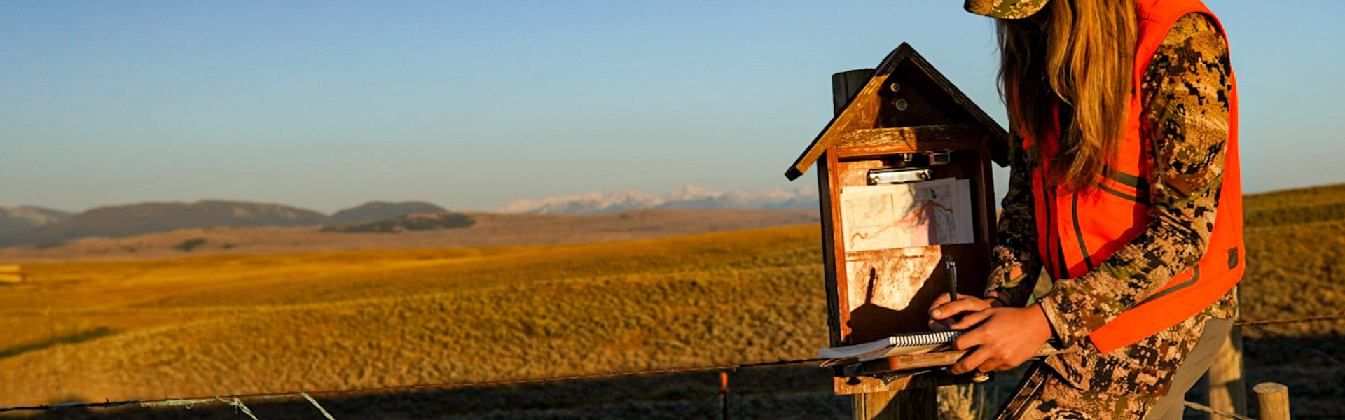
Each BMA has access requirements and hunting use rules specific to that BMA. These rules and access requirements will be listed on the back of each individual Region 4 BMA map. To hunt ANY BMA in Region 4, a hunter (at least one hunter in a group) must first obtain a BMA map from FWP. Maps are valid from 1 September through January 1 of each year. Check the data contained in the annual Hunting Access Guide each year to see if a previously issued map is still current or if a new map is required. Lands are only enrolled in Block Management for the FALL hunting season (September 1–January 1).
The only valid and authorized BMA maps are provided free of charge from either the cooperator direct or from an FWP office. NO OTHER SOURCE(S) ARE AUTHORIZED TO DISTRIBUTE BMA MAPS. Failure to abide by the rules and procedures specified either in the regional guide or on the BMA map violates the conditions of the cooperative agreement between FWP and the landowner, and may result in denial of future access to the BMA and/or citations being issued.
Region 4 landowners are very concerned about noxious weeds. Hunters should ensure vehicles, clothing, and animals are free of mud and debris that may contain weed seeds. Landowners may deny access to hunters driving excessively muddy vehicles that pose a risk of noxious weed introduction.
BMA reservations may not be accepted before August 22.
For BMA information, including information about BMA closures, contact the Region 4 Block Management Office by calling (406) 454-5862, Monday through Friday, 8:30 AM to 4:30 PM, or via the R4 BM e-mail address: fwpr4bmp@mt.gov.
In Region 4, there are over 4.6 million acres of public ownership (Bureau of Land Management, Forest Service, State Lands, and National Wildlife Refuge). This assortment of public land constitutes a land base composition of 18% federal land and 7% State of Montana Department of Natural Resources and Conservation (DNRC) land. These parcels of public land are accessible via public roads or navigable waterways, adjacent public land, and adjacent private land with landowner permission.
FWP administers Wildlife Management Areas (WMAs) throughout the region; each of which provides a culmulative 109,770 acres of hunting opportunity. WMAs in the region include:
Hunters should be aware of seasonal WMA closures to protect wintering wildlife and consult individual maps for additional WMA rules and regulations. WMA maps are available online at http://fwp.mt.gov/gis/maps/huntplanner/
FWP also administers numerous Fishing Access Sites (FASs) and State Parks (SPs) throughout the region that provide some hunting opportunities. These sites include:
Hunters planning on hunting Fishing Access Sites and State Parks should thoroughly review individual site rules and maps. Additional restrictions and area closures may be applicable. FAS and SP maps are available online at https://fwp.mt.gov/gis/maps/huntplanner/
FWP manages hunter-use on several Conservation Easements (CEs) totaling 13,956 acres in Region 4.